New Product |
Great Plains Mapping.Inc
Welcome to the Home of GPS Track Logs
Hello
My name is Jack Baker, and I write Track Logs to be used with a GPS and
GPS Mapping & Sounder Combo. I started creating this data because I think a lot
of fisherman would like to have a general idea of where they are at on the lake.
If you fish with a GPS, I have created track logs which show the river channels, dikes, old roadbeds and some contour depending on how many track points your unit can hold. These track logs I create work best with a Garmin GPS, however can be modified at a slight extra cost to work with others. At the present time I have ability to produce track logs for all the lakes in Kansas, Oklahoma, Missouri and other states are coming soon.
The Lake Map shown below is Hillsdale Lake in Kansas. You see the river channels and creeks within the lake map. I can and do create the same thing to show the channels and creeks in the form of a track log to load into your Garmin GPS and others. You simply upload the track from your PC to your GPS. When you get on the lake, you will see the river channels and etc. You do not have to push many buttons on your GPS, you just zoom in and out and drive your boat to wherever you want to go. It is real user friendly.
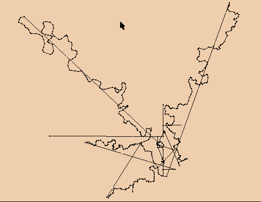
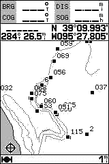
The Garmin GPS is the only GPS that I know of that is able to display several combined track logs without lines running from one track log to the other like the one below. To my knowledge most GPS units will load only 2 to 4 separate track logs. Below shows a track log that is displayed on another GPS that has several track logs combined in it:
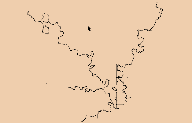
This is why I use a Garmin GPS for what I do. I want it to show exactly the track as I create it. It will also hold a dozen or more track logs. Below shows the same track log (as above) as displayed on a Garmin GPS that has several track logs combined in it. I have added a few features to the track log that shows some of the old roadbeds in the form of the strait lines.
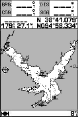
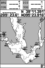
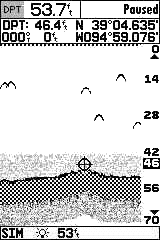
| Below are Screen Shots of a Garmin GPS135 Sounder | |
| Hillsdale Lake with track log loaded
|
Perry zoomed at 8 miles
|
Perry Lake |
GPS map Sounder page |
|
You can freeze the screen and move the cursor down and mark the
exact Latitude and Longitude and depth of the brushpiles. I find this to be very accurate
when using a Differential receiver.
|
Click Here to see a list of Track Logs for these lakes:
| Kansas Lakes |
Missouri Lakes |
Oklahoma Lakes |
Texas Lakes |
I have been doing mapping and GPS work for about seven years. I have done everything possible to obtain or create the best data possible to use in making these track files. In my website, I will try to explain everything so that it is very understandable. I have been fishing for about fifty years and I think I have an idea what the average Fisherman would want to know. I will be glad to answer questions you may have.
Web site: Great Plains Mapping.Inc
Email: Jack Baker
We now have digitized fishing maps on Cd with moving map software to plot the maps and upload and download to most gps units.This software can create waypoints, routes and track files. This software can also be used with a laptop and the maps we have for plotting out your lake or anything else. Please contact for price and avaiability.All images on this page are supplied by Jack Baker or Anglers Fishing Info. All images are copyrighted and can not be reproduced in any form without the written authorization from Jack Baker or Anglers Fishing Info.